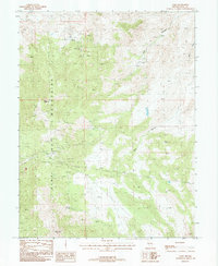
1987 Map of Como
USGS Topo · Published 1988About this map
Pine Nut Mountains dominate this high-desert landscape in Lyon County, revealing an intensive history of resource extraction during the late twentieth century. The mining camp of Como serves as a central point of interest, surrounded by a dense network of industrial markers including a Hercules Mine, several labeled mine shafts, and an expansive strip mine near the western slopes. These features, along with various adits, point to the enduring search for precious metals in this range. Water sources, vital for both mining operations and survival in this arid environment, are specifically identified at Barton Springs and Stone Spring. The topography is defined by high points like Rawe Peak and Lyon Peak, which overlook a series of deep drainages such as Bull Canyon and Mill Canyon, illustrating the challenging environment faced by those working these claims.
Find a feature on this map
14 named features on this map. Tap any name to fly to it.
Don’t see what you’re looking for? This feature index may not catch every label — zoom into the map to look around manually.
Map Details
Editions of this 1987 Como Map
2 editions found
Other maps of this area

1891 · Carson
USGS Topo · 1:125,000

1891 · Wabuska
USGS Topo · 1:125,000

1893 · Carson
USGS Topo · 1:125,000

1894 · Wabuska
USGS Topo · 1:125,000

1950 · Virginia City
USGS Topo · 1:62,500

1952 · Virginia City
USGS Topo · 1:62,500

1956 · Dayton
USGS Topo · 1:62,500

1957 · Como
USGS Topo · 1:62,500

1957 · Churchill Butte
USGS Topo · 1:62,500

1957 · Reno
USGS Topo · 1:250,000