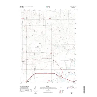
2018 Map of Como
USGS Topo · Published 2018About this map
The Rock River and Elkhorn Creek converge in this corner of Whiteside County, anchoring a landscape defined by small clusters of settlement and an extensive rural road network. The community of Como sits at the river's edge, while Galt and Agnew follow the east-west corridor of Rte 30. This survey provides significant detail for family historians, documenting numerous burial sites such as Como Cem, East Genesee Cem, and the Our Savior Lutheran Cem. Further north, Peugh Cem and Hickory Grove Cem are preserved among the rolling agricultural plots. The map traces the winding paths of French Cr and Deer Cr as they cut through the township, reflecting a terrain where water and rail-lines historically dictated the placement of grain elevators and crossroads hamlets like Emerson and Round Grove.
Find a feature on this map
68 named features on this map. Tap any name to fly to it.
Don’t see what you’re looking for? This feature index may not catch every label — zoom into the map to look around manually.
Map Details
Editions of this 2018 Como Map
This is the sole edition of this map. No revisions or reprints were ever made.
Other maps of this area

1930 · Woodsung
USGS Topo · 1:48,000

1932 · Prophetstown
USGS Topo · 1:48,000

1934 · Morrison
USGS Topo · 1:48,000

1936 · Prophetstown
USGS Topo · 1:62,500

1940 · Morrison
USGS Topo · 1:62,500

1946 · Sterling
USGS Topo · 1:62,500

1948 · Sterling
USGS Topo · 1:62,500

1949 · Walnut
USGS Topo · 1:62,500

1958 · Aurora
USGS Topo · 1:250,000

1961 · Aurora
USGS Topo · 1:250,000