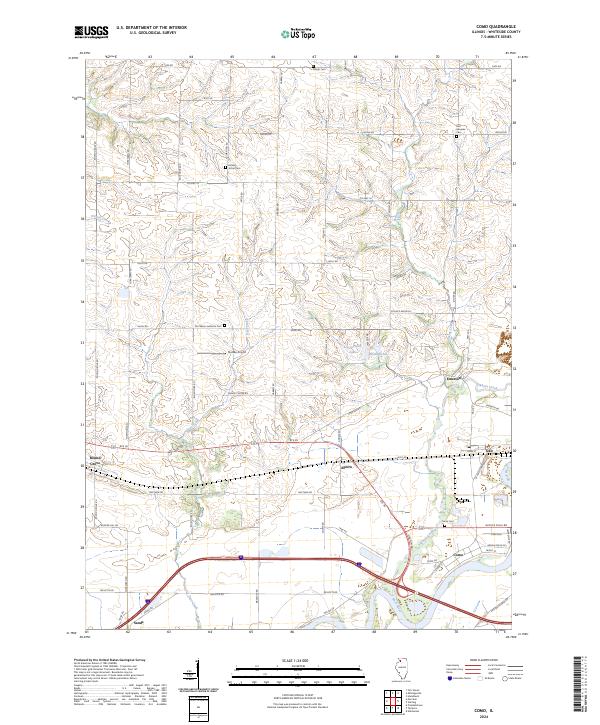
2024 Map of Como
USGS Topo · Published 2024About this map
Rock River dominates the southern reach of this Whiteside County landscape, where the settlement of Como sits just north of the water's edge. This modern survey illustrates a well-organized agricultural and transportation corridor defined by a grid of rural roads like Capp Rd and Science Ridge Rd. The area is dotted with several small communities and historic burying grounds, including Hickory Grove Cem and East Genesee Cem, which provide specific points of interest for those researching local family history. Waterways such as Elkhorn Creek and Deer Creek wind through the terrain, intersecting with major routes like Rte 30. The presence of Stutzke Airport and the smaller clusters at Agnew, Galt, and Emerson show the enduring pattern of rural settlement and infrastructure that has characterized this part of Illinois for generations.
Find a feature on this map
63 named features on this map. Tap any name to fly to it.
Don’t see what you’re looking for? This feature index may not catch every label — zoom into the map to look around manually.
Map Details
Editions of this 2024 Como Map
This is the sole edition of this map. No revisions or reprints were ever made.
Other maps of this area

1930 · Woodsung
USGS Topo · 1:48,000

1932 · Prophetstown
USGS Topo · 1:48,000

1934 · Morrison
USGS Topo · 1:48,000

1936 · Prophetstown
USGS Topo · 1:62,500

1940 · Morrison
USGS Topo · 1:62,500

1946 · Sterling
USGS Topo · 1:62,500

1948 · Sterling
USGS Topo · 1:62,500

1949 · Walnut
USGS Topo · 1:62,500

1958 · Aurora
USGS Topo · 1:250,000

1961 · Aurora
USGS Topo · 1:250,000