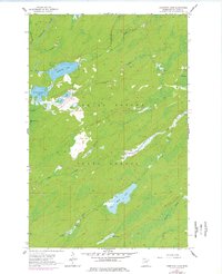
1957 Map of Comstock Lake
USGS Topo · Published 1978About this map
Cloquet Valley State Forest encompasses the vast majority of this landscape, characterized by a dense network of glacial lakes and northern watercourses. The hydrology is dominated by the Whiteface River in the northwest and the Us-Kab-Wan-Ka River flowing through the southern reach. The central portion of the survey is defined by the connected waters of Comstock Lake and Lower Comstock Lake, which feed into the meandering path of Gimlet Cr.
Find a feature on this map
17 named features on this map. Tap any name to fly to it.
Don’t see what you’re looking for? This feature index may not catch every label — zoom into the map to look around manually.
Map Details
Editions of this 1957 Comstock Lake Map
3 editions found
Other maps of this area

1951 · Makinen
USGS Topo · 1:24,000

1953 · Shaw
USGS Topo · 1:24,000

1953 · Boulder Lake Reservoir
USGS Topo · 1:24,000

1954 · Thompson Lake
USGS Topo · 1:24,000

1954 · Hibbing
USGS Topo · 1:250,000

1956 · Whiteface
USGS Topo · 1:24,000

1957 · Hibbing
USGS Topo · 1:250,000

1957 · Markham
USGS Topo · 1:62,500

1957 · Comstock Lake
USGS Topo · 1:24,000
1957 · Boulder Lake Reservoir NE
USGS Topo · 1:24,000