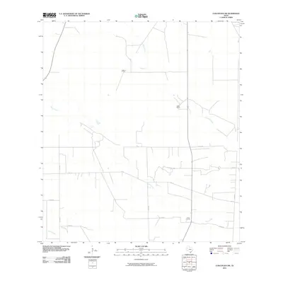
2010 Map of Concepcion NW
USGS Topo · Published 2010About this map
Longhorn Oil Field sits in the brush country of Duval County, marking the extraction-based industry of this South Texas landscape. This early 21st-century survey documents a network of rural county roads, such as Co RD 270 and Co RD 261, that crisscross the arid terrain to connect scattered ranching outposts like Miller Ranch. The drainage patterns of Los Olmos Creek, Macho Creek, and Cibolo Creek define the geography, while Vicinity Cemetery provides a specific point of interest for genealogists tracing local families. The prominence of Farm to Market roads, including FM 716, illustrates the infrastructure required to support the region's agricultural and energy sectors during this era.
Find a feature on this map
17 named features on this map. Tap any name to fly to it.
Don’t see what you’re looking for? This feature index may not catch every label — zoom into the map to look around manually.
Map Details
Editions of this 2010 Concepcion NW Map
This is the sole edition of this map. No revisions or reprints were ever made.
Other maps of this area

1921 · Falfurrias
USGS Topo · 1:125,000

1956 · Benavides
USGS Topo · 1:62,500

1956 · Laredo
USGS Topo · 1:250,000

1967 · Hebbronville SE
USGS Topo · 1:24,000

1967 · Parrilla Creek SE
USGS Topo · 1:24,000

1967 · Realitos
USGS Topo · 1:24,000

1968 · Concepcion
USGS Topo · 1:24,000

1968 · San Jose
USGS Topo · 1:24,000

1968 · Benavides
USGS Topo · 1:24,000

1968 · Concepcion NW
USGS Topo · 1:24,000