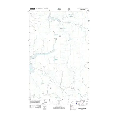
2011 Map of Conconully East
USGS Topo · Published 2011About this map
Conconully sits at the heart of this Okanogan County landscape, where the management of water and mining history define the terrain. The community is flanked by significant engineering works including the Conconully Dam and Salmon Lake Dam, which regulate the Conconully Reservoir and Conconully Lake. These water bodies are central to the region's geography, tucked between prominent heights like Funk Mountain and Sugarloaf Mountain.
Find a feature on this map
46 named features on this map. Tap any name to fly to it.
Don’t see what you’re looking for? This feature index may not catch every label — zoom into the map to look around manually.
Map Details
Editions of this 2011 Conconully East Map
This is the sole edition of this map. No revisions or reprints were ever made.
Other maps of this area

1905 · Okanogan
USGS Topo · 1:125,000

1906 · Chopaka
USGS Topo · 1:125,000

1954 · Okanogan
USGS Topo · 1:250,000

1956 · Loup Loup
USGS Topo · 1:62,500

1956 · Tiffany Mountain
USGS Topo · 1:62,500

1957 · Okanogan
USGS Topo · 1:62,500

1957 · Conconully
USGS Topo · 1:62,500

1958 · Okanogan
USGS Topo · 1:250,000
1980 · Omak
USGS Topo · 1:24,000
1980 · Aeneas Lake
USGS Topo · 1:24,000