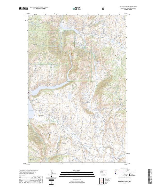
2023 Map of Conconully East
USGS Topo · Published 2023About this map
Conconully and its surrounding highlands define this portion of the Okanogan National Forest in central Washington. The landscape is marked by significant water management and glacial terrain, with the Conconully Reservoir and Conconully Lake dominating the western edge, while smaller bodies like Sugarloaf Lake, Fish Lake, and Honey Lake are scattered through the hills. Genealogists and local historians can find the Conconully Cem and Ruby Cem, alongside the descriptive Graveyard Flat south of the main reservoir. The map reveals a transition from the structured street grid of the town to the mining and ranching history suggested by the Lime Belt settlement and peaks such as Schalow Mtn and Dunn Mtn. This area near the Salmon Creek drainage serves as a critical junction between the rugged heights of Funk Mtn and the lower basin of Scotch Creek.
Find a feature on this map
46 named features on this map. Tap any name to fly to it.
Don’t see what you’re looking for? This feature index may not catch every label — zoom into the map to look around manually.
Map Details
Editions of this 2023 Conconully East Map
This is the sole edition of this map. No revisions or reprints were ever made.
Other maps of this area

1905 · Okanogan
USGS Topo · 1:125,000

1906 · Chopaka
USGS Topo · 1:125,000

1954 · Okanogan
USGS Topo · 1:250,000

1956 · Loup Loup
USGS Topo · 1:62,500

1956 · Tiffany Mountain
USGS Topo · 1:62,500

1957 · Okanogan
USGS Topo · 1:62,500

1957 · Conconully
USGS Topo · 1:62,500

1958 · Okanogan
USGS Topo · 1:250,000
1980 · Omak
USGS Topo · 1:24,000
1980 · Aeneas Lake
USGS Topo · 1:24,000