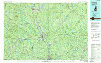
1988 Map of Concord
USGS Topo · Published 1988About this map
The Merrimack River valley anchors this 1988 map, serving as the primary corridor for development between Concord and northern Manchester. The terrain is characterized by the convergence of several major waterways, including the Contoocook River, Suncook River, and Winnipesaukee River, which historically powered the industrial centers of the region. Transportation networks are prominent, featuring the Boston and Maine RR following the riverbanks and the intersection of Interstate 93 and Interstate 89, illustrating the area's role as a New Hampshire transit hub.
Find a feature on this map
108 named features on this map. Tap any name to fly to it.
Don’t see what you’re looking for? This feature index may not catch every label — zoom into the map to look around manually.
Map Details
Editions of this 1988 Concord Map
This is the sole edition of this map. No revisions or reprints were ever made.
Other maps of this area

1888 · Newburyport
USGS Topo · 1:62,500

1888 · Haverhill
USGS Topo · 1:62,500

1890 · Haverhill
USGS Topo · 1:62,500

1890 · Newburyport
USGS Topo · 1:62,500

1891 · Berwick
USGS Topo · 1:62,500

1891 · Newfield
USGS Topo · 1:62,500

1893 · Dover
USGS Topo · 1:62,500

1893 · Berwick
USGS Topo · 1:62,500

1893 · Newfield
USGS Topo · 1:62,500

1893 · Haverhill
USGS Topo · 1:62,500