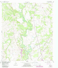
1960 Map of Concrete
USGS Topo · Published 1987About this map
The Guadalupe River carves a winding path through this portion of DeWitt County, anchoring a landscape defined by ranching, early aviation, and rural civic life. Near the small settlement of Concrete, the terrain is marked by a series of family and community burial grounds, including the San Pedro Cem and Nelms Cem, reflecting the deep genealogical roots of the area. The presence of the Valley View Sch and the Buchel Community Center suggests a well-established social fabric in the mid-20th century.
Find a feature on this map
23 named features on this map. Tap any name to fly to it.
Don’t see what you’re looking for? This feature index may not catch every label — zoom into the map to look around manually.
Map Details
Editions of this 1960 Concrete Map
3 editions found
Other maps of this area

1953 · Seguin
USGS Topo · 1:250,000

1958 · Seguin
USGS Topo · 1:250,000

1959 · Hochheim
USGS Topo · 1:24,000

1960 · Cuero
USGS Topo · 1:24,000

1960 · Concrete
USGS Topo · 1:24,000

1960 · Blackwell Lake
USGS Topo · 1:24,000

1960 · Cheapside
USGS Topo · 1:24,000

1960 · Westhoff
USGS Topo · 1:24,000

1962 · Verhelle
USGS Topo · 1:24,000

1962 · Edgar
USGS Topo · 1:24,000