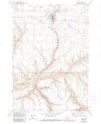
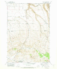
1970 Map of Condon
USGS Topo · Published 1987About this map
Condon stands as the primary hub of this high plateau region in Gilliam County, characterized by the dramatic incision of steep-walled canyons into the surrounding agricultural tablelands. The town's grid is dense with civic infrastructure, featuring grain elevators and a rail line that speak to its role in the regional wheat economy during the early 1970s. Beyond the developed center, the landscape is defined by the sharp drop into Condon Canyon and numerous unnamed drainages where small water sources like Spring are essential landmarks in an otherwise arid terrain. This mapping, updated with 1980s aerial data, reveals the relationship between the town’s elevated position and the complex network of draws and flats that extend toward the John Day River basin.
Find a feature on this map
2 named features on this map. Tap any name to fly to it.
Don’t see what you’re looking for? This feature index may not catch every label — zoom into the map to look around manually.
Map Details
Editions of this 1970 Condon Map
2 editions found
Other maps of this area

1916 · Condon
USGS Topo · 1:125,000

1953 · The Dalles
USGS Topo · 1:250,000

1956 · The Dalles
USGS Topo · 1:250,000

1957 · The Dalles
USGS Topo · 1:250,000

1970 · Igo Butte
USGS Topo · 1:24,000
1970 · Schott Canyon
USGS Topo · 1:24,000

1970 · Condon
USGS Topo · 1:24,000
1970 · Salmon Fork
USGS Topo · 1:24,000
1970 · Buckhorn Canyon
USGS Topo · 1:24,000
1970 · Fossil North
USGS Topo · 1:24,000