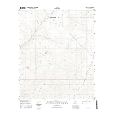
2014 Map of Cone Butte
USGS Topo · Published 2014About this map
Cedar Creek Crossing serves as a central point of reference in this Gila County landscape, where Bureau of Indian Affairs routes like Bia-24 and Bia-38 intersect. The area is defined by a sophisticated network of water management features essential for livestock and local use, including Cemetery Tank, Apache Pond Number One, and Sam Green Tank. These tanks, often named for specific families or local landmarks, dot the drainages of Cedar Creek and G Wash.
Find a feature on this map
61 named features on this map. Tap any name to fly to it.
Don’t see what you’re looking for? This feature index may not catch every label — zoom into the map to look around manually.
Map Details
Editions of this 2014 Cone Butte Map
This is the sole edition of this map. No revisions or reprints were ever made.
Other maps of this area
1954 · Mesa
USGS Topo · 1:250,000
1957 · Mesa
USGS Topo · 1:250,000
1958 · Mesa
USGS Topo · 1:250,000
1960 · Mesa
USGS Topo · 1:250,000
1964 · Mesa
USGS Topo · 1:250,000
1966 · Popcorn Canyon
USGS Topo · 1:24,000
1966 · Forks Butte
USGS Topo · 1:24,000
1966 · Round Top Mtn
USGS Topo · 1:24,000
1966 · Carrizo
USGS Topo · 1:24,000
1966 · Cone Butte
USGS Topo · 1:24,000