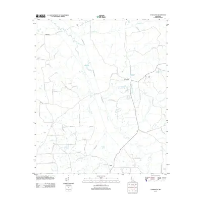
2012 Map of Conehatta
USGS Topo · Published 2012About this map
Conehatta and the surrounding Scott County landscape are defined by an intricate network of waterways, including Tuscolameta Creek and Bollybusha Cr. This 2012 survey reveals a rural territory where small settlements like Piketown and Hazel are connected by local routes such as Old Jackson Rd and Newton Conehatta Rd. The presence of numerous family and community burial grounds, including Amis Cem, Futchs Cem, and Pleasant Hill Cem, provides a detailed record of local genealogy and the distribution of historic homesteads throughout the area. To the south, the engineering of the Warrior Canal stands out against the natural winding paths of Crooked Wood Cr and Sellers Cr, illustrating the ongoing management of the region's hydrography.
Find a feature on this map
89 named features on this map. Tap any name to fly to it.
Don’t see what you’re looking for? This feature index may not catch every label — zoom into the map to look around manually.
Map Details
Editions of this 2012 Conehatta Map
This is the sole edition of this map. No revisions or reprints were ever made.
Other maps of this area

1921 · Forest
USGS Topo · 1:48,000

1922 · Forest
USGS Topo · 1:62,500

1950 · Forest
USGS Topo · 1:62,500

1952 · Forest
USGS Topo · 1:62,500

1953 · Meridian
USGS Topo · 1:250,000

1957 · Meridian
USGS Topo · 1:250,000

1965 · Meridian
USGS Topo · 1:250,000

1966 · Newton
USGS Topo · 1:24,000

1966 · Decatur NW
USGS Topo · 1:24,000
1972 · Sebastopol
USGS Topo · 1:24,000