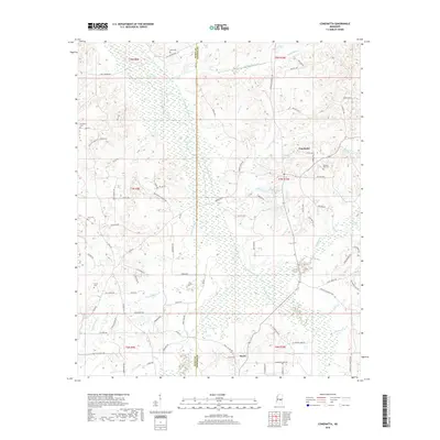
2018 Map of Conehatta
USGS Topo · Published 2018About this map
Tuscolameta Creek and its managed watercourse, the Warrior Canal, define the low-lying drainage patterns across the border of Scott and Newton counties. This 2018 survey reveals a landscape largely dominated by timber and agriculture, centered around the unincorporated communities of Conehatta and Hazel. The mapping of small water bodies like Big Lake, Carson Pond, and Community Pond suggests a local economy and ecology tied closely to these wetlands and tributaries.
Find a feature on this map
92 named features on this map. Tap any name to fly to it.
Don’t see what you’re looking for? This feature index may not catch every label — zoom into the map to look around manually.
Map Details
Editions of this 2018 Conehatta Map
This is the sole edition of this map. No revisions or reprints were ever made.
Other maps of this area

1921 · Forest
USGS Topo · 1:48,000

1922 · Forest
USGS Topo · 1:62,500

1950 · Forest
USGS Topo · 1:62,500

1952 · Forest
USGS Topo · 1:62,500

1953 · Meridian
USGS Topo · 1:250,000

1957 · Meridian
USGS Topo · 1:250,000

1965 · Meridian
USGS Topo · 1:250,000

1966 · Newton
USGS Topo · 1:24,000

1966 · Decatur NW
USGS Topo · 1:24,000
1972 · Sebastopol
USGS Topo · 1:24,000