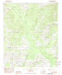
1982 Map of Conehatta
USGS Topo · Published 1983About this map
The Choctaw Indian Reservation dominates the landscape of this 1982 survey, spanning the boundary between Scott and Newton counties. The area is defined by a dense network of waterways, including Tuscolameta Creek and Bollybusha Creek, which feed into engineered channels like Big Canal and Little Canal. These drainage patterns suggest a landscape carefully managed for agriculture or flood control within the reservation and surrounding rural districts.
Find a feature on this map
39 named features on this map. Tap any name to fly to it.
Don’t see what you’re looking for? This feature index may not catch every label — zoom into the map to look around manually.
Map Details
Editions of this 1982 Conehatta Map
This is the sole edition of this map. No revisions or reprints were ever made.
Other maps of this area

1921 · Forest
USGS Topo · 1:48,000

1922 · Forest
USGS Topo · 1:62,500

1950 · Forest
USGS Topo · 1:62,500

1952 · Forest
USGS Topo · 1:62,500

1953 · Meridian
USGS Topo · 1:250,000

1957 · Meridian
USGS Topo · 1:250,000

1965 · Meridian
USGS Topo · 1:250,000

1966 · Newton
USGS Topo · 1:24,000

1966 · Decatur NW
USGS Topo · 1:24,000
1972 · Sebastopol
USGS Topo · 1:24,000