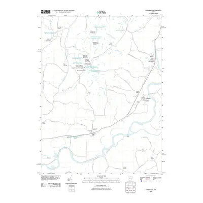
2010 Map of Conesville
USGS Topo · Published 2010About this map
The Muskingum River dominates the southern reaches of this landscape, carving a wide path past the historic settlements of Adams Mills and Conesville. The region's industrial character is defined by extensive coal operations, marked by several slurry ponds and impoundments including Broken Aro Sedimentation Reservoir Number Four and the Peabody Coal Company Impoundment 0117. These features suggest a landscape heavily modified by late 20th-century resource extraction, contrasting with the much older agricultural and small-town grid pattern found at Franklin and Tyndall. For genealogists, the map is particularly rich with resting places such as the Branch Methodist Episcopal Cemetery, Warner Methodist Cemetery, and Saint Matthews Cemetery. Transport and utility are evidenced by local airfields like Graham Farm Airport and the complex drainage networks of Mill Fork and Moscow Brook.
Find a feature on this map
84 named features on this map. Tap any name to fly to it.
Don’t see what you’re looking for? This feature index may not catch every label — zoom into the map to look around manually.
Map Details
Editions of this 2010 Conesville Map
This is the sole edition of this map. No revisions or reprints were ever made.
Other maps of this area

1908 · Conesville
USGS Topo · 1:62,500

1910 · Frazeysburg
USGS Topo · 1:62,500

1910 · Conesville
USGS Topo · 1:62,500

1913 · Brinkhaven
USGS Topo · 1:62,500

1913 · Coshocton
USGS Topo · 1:62,500

1915 · Brinkhaven
USGS Topo · 1:62,500

1915 · Coshocton
USGS Topo · 1:62,500

1943 · Coshocton
USGS Topo · 1:62,500

1950 · Marion
USGS Topo · 1:250,000

1951 · Canton
USGS Topo · 1:250,000