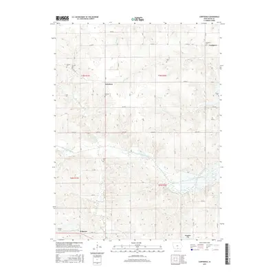
2015 Map of Confidence
USGS Topo · Published 2015About this map
Promise City and the surrounding rural townships of Wayne County are defined by the meandering course of the S Fork Chariton River and its varied tributaries. The landscape is dotted with small, historically significant settlements like Confidence and Bethelhem, which serve as quiet nodes in an extensive network of county roads. For genealogists and local historians, this map is particularly valuable for its high density of family and community burial grounds, including the Confidence Cem, Bethlehem Cem, and the uniquely named New York Cem. These sites, along with the McDaniel Cem and Lacey Cem, mark the persistent heritage of early settlers across the prairie. The presence of the Corydon Airport near Bridgeport indicates the modern infrastructure that connects this agrarian region to the wider state.
Find a feature on this map
33 named features on this map. Tap any name to fly to it.
Don’t see what you’re looking for? This feature index may not catch every label — zoom into the map to look around manually.
Map Details
Editions of this 2015 Confidence Map
This is the sole edition of this map. No revisions or reprints were ever made.
Other maps of this area

1934 · Humeston
USGS Topo · 1:48,000

1935 · Russell
USGS Topo · 1:62,500

1937 · Corydon
USGS Topo · 1:62,500

1938 · Russell
USGS Topo · 1:62,500

1942 · Seymour
USGS Topo · 1:62,500

1944 · Seymour
USGS Topo · 1:62,500

1954 · Centerville
USGS Topo · 1:250,000

1957 · Centerville
USGS Topo · 1:250,000

1958 · Centerville
USGS Topo · 1:250,000

1964 · Allerton
USGS Topo · 1:24,000