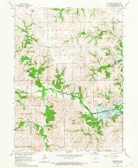
1966 Map of Confidence
USGS Topo · Published 1967About this map
Bethlehem and Confidence serve as the primary rural hubs in this mid-1960s survey of Wayne County, showing a landscape defined by traditional agrarian settlement patterns and the emerging impact of water management. The South Fork Chariton River winds through the central terrain, while the southeastern corner of the map records the development of the Rathbun Reservoir, including the note for its normal pool elevation 904.
Find a feature on this map
21 named features on this map. Tap any name to fly to it.
Don’t see what you’re looking for? This feature index may not catch every label — zoom into the map to look around manually.
Map Details
Editions of this 1966 Confidence Map
This is the sole edition of this map. No revisions or reprints were ever made.
Other maps of this area

1934 · Humeston
USGS Topo · 1:48,000

1935 · Russell
USGS Topo · 1:62,500

1937 · Corydon
USGS Topo · 1:62,500

1938 · Russell
USGS Topo · 1:62,500

1942 · Seymour
USGS Topo · 1:62,500

1944 · Seymour
USGS Topo · 1:62,500

1954 · Centerville
USGS Topo · 1:250,000

1957 · Centerville
USGS Topo · 1:250,000

1958 · Centerville
USGS Topo · 1:250,000

1964 · Allerton
USGS Topo · 1:24,000