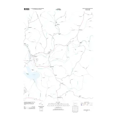
2013 Map of Confluence
USGS Topo · Published 2013About this map
Confluence sits at the dramatic meeting of the Youghiogheny River, the Casselman River, and Laurel Hill Cr, a geographic junction that defined the settlement patterns of this corner of Somerset County. By the early 21st century, the landscape reflects a complex history of resource extraction and transit, evidenced by named hollows such as Coke Oven Hollow and Smith Hollow near Humbert. The rugged topography is pierced by engineering feats including Brooks Tunnel, Benford Tunnel, and Shoofly Tunnel, which allowed rail or road passage through the steep river valleys. To the south, the expansion of the Youghiogheny River Lake has reshaped the valley near Klondike Ridge and Horseshoe Bend. Smaller hamlets like Ursina, Harnedsville, and Listonburg dot the corridors of Whites Cr and the larger rivers, maintaining the character of rural Pennsylvania mountain communities.
Find a feature on this map
113 named features on this map. Tap any name to fly to it.
Don’t see what you’re looking for? This feature index may not catch every label — zoom into the map to look around manually.
Map Details
Editions of this 2013 Confluence Map
This is the sole edition of this map. No revisions or reprints were ever made.
Other maps of this area

1899 · Grantsville
USGS Topo · 1:62,500

1900 · Accident
USGS Topo · 1:62,500

1904 · Grantsville
USGS Topo · 1:62,500

1921 · Meyersdale
USGS Topo · 1:62,500

1922 · Confluence
USGS Topo · 1:62,500

1931 · Confluence
USGS Topo · 1:62,500

1933 · Confluence
USGS Topo · 1:62,500

1939 · Meyersdale
USGS Topo · 1:62,500

1944 · Meyersdale
USGS Topo · 1:62,500

1946 · Grantsville
USGS Topo · 1:24,000
Featured Places
- Confluence, PA
- Ursina, PA
- Lower Turkeyfoot Township, PA
- Henry Clay Township, PA
- Upper Turkeyfoot Township, PA