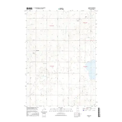
2016 Map of Conger
USGS Topo · Published 2016About this map
Conger and Mansfield anchor this rural section of Freeborn County, reflecting a landscape shaped by agricultural drainage and early 20th-century settlement patterns. The map detail highlights an intricate network of man-made waterways, such as Judicial Ditch Number Twenty-five and County Ditch Number Forty-eight, which were critical for converting the wetlands of the prairie into productive farmland. This water management system connects naturally to the E Br Blue Earth River and Steward Cr, illustrating the region's hydrographic history.
Find a feature on this map
37 named features on this map. Tap any name to fly to it.
Don’t see what you’re looking for? This feature index may not catch every label — zoom into the map to look around manually.
Map Details
Editions of this 2016 Conger Map
This is the sole edition of this map. No revisions or reprints were ever made.
Other maps of this area

1954 · Albert Lea
USGS Topo · 1:62,500

1954 · Mason City
USGS Topo · 1:250,000

1955 · Wells
USGS Topo · 1:62,500

1957 · Mason City
USGS Topo · 1:250,000

1958 · Mason City
USGS Topo · 1:250,000

1972 · Bristol
USGS Topo · 1:24,000

1972 · Vinje
USGS Topo · 1:24,000
1972 · Lake Mills
USGS Topo · 1:24,000

1982 · Albert Lea West
USGS Topo · 1:24,000
1982 · Emmons
USGS Topo · 1:24,000