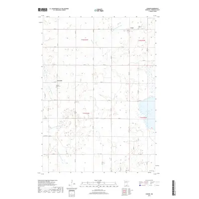
2019 Map of Conger
USGS Topo · Published 2019About this map
The agricultural landscape of Freeborn County is defined by its intricate drainage network and dispersed rural settlements. Conger serves as a central hub for the township, while the smaller community of Mansfield sits further west near the E Br Blue Earth River. This region is notable for its extensive water management systems, documented through engineered waterways such as County Ditch Number Forty-eight, Judicial Ditch Number Twenty-five, and Judicial Ditch Number Twenty-six, which have historically reshaped the wet prairie into productive farmland. Genealogists will find a high concentration of burial sites marking early family and church history, including the Conger Community Cem, Mansfield Lutheran Cem, and the remote Schnieder Cem. To the southeast, the open water of Bear Lake provides a natural contrast to the grid of gravel roads and surveyed township lines that organize the surrounding countryside.
Find a feature on this map
49 named features on this map. Tap any name to fly to it.
Don’t see what you’re looking for? This feature index may not catch every label — zoom into the map to look around manually.
Map Details
Editions of this 2019 Conger Map
This is the sole edition of this map. No revisions or reprints were ever made.
Other maps of this area

1954 · Albert Lea
USGS Topo · 1:62,500

1954 · Mason City
USGS Topo · 1:250,000

1955 · Wells
USGS Topo · 1:62,500

1957 · Mason City
USGS Topo · 1:250,000

1958 · Mason City
USGS Topo · 1:250,000

1972 · Bristol
USGS Topo · 1:24,000

1972 · Vinje
USGS Topo · 1:24,000
1972 · Lake Mills
USGS Topo · 1:24,000

1982 · Albert Lea West
USGS Topo · 1:24,000
1982 · Emmons
USGS Topo · 1:24,000