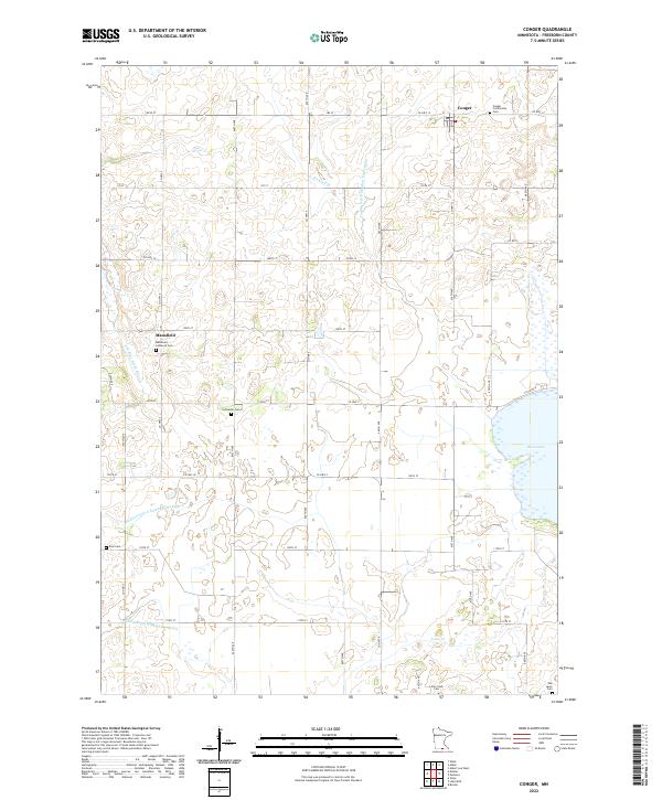
2022 Map of Conger
USGS Topo · Published 2022About this map
The village of Conger and the settlement at Mansfield anchor this Freeborn County landscape, defined by a complex network of agricultural drainage and natural watercourses. The drainage of the upper Midwest is clearly visible here, as natural features like the E Br Blue Earth River, Lime Cr, and Steward Cr are integrated with man-made systems such as Judicial Ditch Number Twenty-five and County Ditch Number Forty-eight. This interplay illustrates the long history of land reclamation and waterway management in southern Minnesota. For genealogists and local historians, the sheet is particularly valuable for its density of rural cemeteries, including the Conger Community Cem, Mansfield Lutheran Cem, and the smaller Schnieder Cem, each preserving the names and heritage of the area's early farming families. Near the eastern edge, Bear Lake remains a prominent local landmark among the gridded section lines of t101n r22w.
Find a feature on this map
36 named features on this map. Tap any name to fly to it.
Don’t see what you’re looking for? This feature index may not catch every label — zoom into the map to look around manually.
Map Details
Editions of this 2022 Conger Map
This is the sole edition of this map. No revisions or reprints were ever made.
Other maps of this area

1954 · Albert Lea
USGS Topo · 1:62,500

1954 · Mason City
USGS Topo · 1:250,000

1955 · Wells
USGS Topo · 1:62,500

1957 · Mason City
USGS Topo · 1:250,000

1958 · Mason City
USGS Topo · 1:250,000

1972 · Bristol
USGS Topo · 1:24,000

1972 · Vinje
USGS Topo · 1:24,000
1972 · Lake Mills
USGS Topo · 1:24,000

1982 · Albert Lea West
USGS Topo · 1:24,000
1982 · Emmons
USGS Topo · 1:24,000