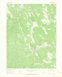
1965 Map of Conifer
USGS Topo · Published 1967About this map
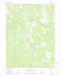
Evergreen and the surrounding mountain settlements of Jefferson County show a landscape of mid-century residential growth and preserved parkland. High-altitude living is evident in the development of Broken Arrow Acres and Green Valley Acres, alongside essential community hubs like the Wild Rose Grange and Pleasant Park Grange. The map identifies local educational landmarks such as Wilmot Sch and West Jefferson Sch, which served the expanding population as these former summer retreats became year-round communities.
Find a feature on this map
55 named features on this map. Tap any name to fly to it.
Don’t see what you’re looking for? This feature index may not catch every label — zoom into the map to look around manually.
Map Details
Editions of this 1965 Conifer Map
7 editions found
Other maps of this area

1893 · Platte Canyon
USGS Topo · 1:125,000

1899 · West Denver
USGS Topo · 1:125,000

1938 · Morrison
USGS Topo · 1:24,000

1942 · Morrison
USGS Topo · 1:31,680

1945 · Indian Hills
USGS Topo · 1:31,680

1945 · Platte Canyon
USGS Topo · 1:24,000

1945 · Pine
USGS Topo · 1:24,000

1945 · Bailey
USGS Topo · 1:24,000
1947 · Morrison
USGS Topo · 1:31,680

1948 · Pine
USGS Topo · 1:24,000