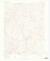
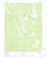
1965 Map of Conifer
USGS Topo · Published 1973About this map
Evergreen and the surrounding mountain foothills of Jefferson County are captured in this mid-century topographic survey, revealing a landscape of early residential growth and historical mountain ranching. The map details established settlements like Marshdale, Aspen Park, and Conifer, alongside newer developments such as Broken Arrow Acres and Green Valley Acres. Educational and social hubs of the era are well-documented, including Wilmot Sch, West Jefferson Sch, and the local fraternal chapters at Wild Rose Grange and Pleasant Park Grange. The rugged geography is defined by prominent peaks like Evergreen Mountain and Berrian Mountain, while the winding course of North Turkey Creek and South Turkey Creek shapes the local drainage. Traces of the region's mining past remain visible at the Augusta Mine, and the cultural landscape is marked by landmarks like Our Lady of the Rockies Camp and the Evergreen Memorial Park (Cem).
Find a feature on this map
54 named features on this map. Tap any name to fly to it.
Don’t see what you’re looking for? This feature index may not catch every label — zoom into the map to look around manually.
Map Details
Editions of this 1965 Conifer Map
7 editions found
Other maps of this area

1893 · Platte Canyon
USGS Topo · 1:125,000

1899 · West Denver
USGS Topo · 1:125,000

1938 · Morrison
USGS Topo · 1:24,000

1942 · Morrison
USGS Topo · 1:31,680

1945 · Indian Hills
USGS Topo · 1:31,680

1945 · Platte Canyon
USGS Topo · 1:24,000

1945 · Pine
USGS Topo · 1:24,000

1945 · Bailey
USGS Topo · 1:24,000
1947 · Morrison
USGS Topo · 1:31,680

1948 · Pine
USGS Topo · 1:24,000