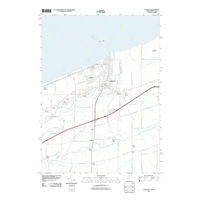
2010 Map of Conneaut
USGS Topo · Published 2010About this map
Conneaut and its surrounding communities are defined by the winding course of Conneaut Creek as it approaches Lake Erie. This 2010 survey shows the dense residential grid of Lakeville and East Conneaut meeting the industrial and maritime infrastructure of the lakeshore. Evidence of the region's shipping economy is found at the Perry Bluff Ore Storage Area and the Conneaut Municipal Water Works near the harbor entrance, guarded by the West Breakwater Light.
Find a feature on this map
62 named features on this map. Tap any name to fly to it.
Don’t see what you’re looking for? This feature index may not catch every label — zoom into the map to look around manually.
Map Details
Editions of this 2010 Conneaut Map
This is the sole edition of this map. No revisions or reprints were ever made.
Other maps of this area

1900 · Girard
USGS Topo · 1:62,500

1900 · Fairview
USGS Topo · 1:62,500

1906 · Conneaut
USGS Topo · 1:62,500

1950 · Cleveland
USGS Topo · 1:250,000

1950 · Erie
USGS Topo · 1:250,000

1956 · Cleveland
USGS Topo · 1:250,000

1957 · Fairview SW
USGS Topo · 1:24,000

1959 · East Springfield
USGS Topo · 1:24,000

1959 · Beaver Center
USGS Topo · 1:24,000

1959 · Erie
USGS Topo · 1:250,000