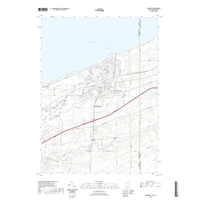
2019 Map of Conneaut
USGS Topo · Published 2019About this map
Conneaut stands as a significant lakeside and border community where the winding path of Conneaut Creek meets Lake Erie at Conneaut Harbor. The map reveals a densely gridded residential and commercial core transitioning into more dispersed settlements like Amboy, East Conneaut, and Farnham. For genealogists and local historians, the sheet is particularly dense with burial sites, including Glenwood Cem, Saint Josephs Cem, and the City Cem, alongside smaller rural grounds like Clarks Corner Cem. The infrastructure is defined by its relation to the water, noted by prominent crossings such as the Creek Road Bridge, Middle Road Bridge, and State Road Bridge. The eastern margin of the map traces the Ohio Pennsylvania border along State Line Rd, illustrating how the town's development was constrained and shaped by both the lakefront and the interstate boundary.
Find a feature on this map
96 named features on this map. Tap any name to fly to it.
Don’t see what you’re looking for? This feature index may not catch every label — zoom into the map to look around manually.
Map Details
Editions of this 2019 Conneaut Map
This is the sole edition of this map. No revisions or reprints were ever made.
Other maps of this area

1900 · Girard
USGS Topo · 1:62,500

1900 · Fairview
USGS Topo · 1:62,500

1906 · Conneaut
USGS Topo · 1:62,500

1950 · Cleveland
USGS Topo · 1:250,000

1950 · Erie
USGS Topo · 1:250,000

1956 · Cleveland
USGS Topo · 1:250,000

1957 · Fairview SW
USGS Topo · 1:24,000

1959 · East Springfield
USGS Topo · 1:24,000

1959 · Beaver Center
USGS Topo · 1:24,000

1959 · Erie
USGS Topo · 1:250,000