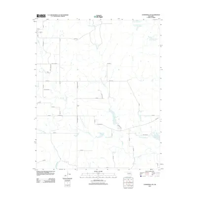
2012 Map of Connerville NE
USGS Topo · Published 2012About this map
Blue River and Delaware Cr wind through this Johnston County landscape, which is defined by an extensive network of natural springs and managed water resources. Local water sources such as Kelly Spring, Houghtubby Spring, and the uniquely named Witch Hole dot the terrain, alongside several flood control structures including Upper Clear Boggy Cr Site 11 Reservoir. For genealogists and local historians, the presence of Pontotoc Cem, Seeley Cem, and Pilgrim Cem provides specific points for family research. The road network, including Tyson Swine Rd and Deadman Spring Rd, reflects the agricultural and rural character of the region. The map also captures several distinct watercourses such as Little Blue Cr, Walnut Br, and Sandy Cr, illustrating the drainage patterns of south-central Oklahoma.
Find a feature on this map
55 named features on this map. Tap any name to fly to it.
Don’t see what you’re looking for? This feature index may not catch every label — zoom into the map to look around manually.
Map Details
Editions of this 2012 Connerville NE Map
This is the sole edition of this map. No revisions or reprints were ever made.
Other maps of this area

1896 · Coalgate
USGS Topo · 1:125,000

1899 · Coalgate
USGS Topo · 1:125,000

1899 · Atoka
USGS Topo · 1:125,000

1900 · Atoka
USGS Topo · 1:125,000

1900 · Coalgate
USGS Topo · 1:125,000

1901 · Stonewall
USGS Topo · 1:125,000

1901 · Tishomingo
USGS Topo · 1:125,000

1957 · Ardmore
USGS Topo · 1:250,000

1963 · Ardmore
USGS Topo · 1:250,000
1966 · Tupelo
USGS Topo · 1:24,000