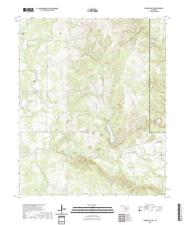
2022 Map of Connerville NE
USGS Topo · Published 2022About this map
Bromide and the surrounding rural landscapes of Johnston and Coal counties are captured here in a period of modern topography. The area is defined by the convergence of several major water systems, including the Blue River and Delaware Creek, which feed into engineered catchments like the Delaware Cr Site 8 Reservoir. This terrain is deeply intertwined with local family and community history, as evidenced by the network of named rural routes such as Harris Ranch Rd and Tyson Swine Rd.
Find a feature on this map
55 named features on this map. Tap any name to fly to it.
Don’t see what you’re looking for? This feature index may not catch every label — zoom into the map to look around manually.
Map Details
Editions of this 2022 Connerville NE Map
This is the sole edition of this map. No revisions or reprints were ever made.
Other maps of this area

1896 · Coalgate
USGS Topo · 1:125,000

1899 · Coalgate
USGS Topo · 1:125,000

1899 · Atoka
USGS Topo · 1:125,000

1900 · Atoka
USGS Topo · 1:125,000

1900 · Coalgate
USGS Topo · 1:125,000

1901 · Stonewall
USGS Topo · 1:125,000

1901 · Tishomingo
USGS Topo · 1:125,000

1957 · Ardmore
USGS Topo · 1:250,000

1963 · Ardmore
USGS Topo · 1:250,000
1966 · Tupelo
USGS Topo · 1:24,000