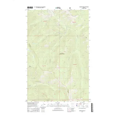
2017 Map of Connor Creek
USGS Topo · Published 2017About this map
The Swan Range dominates this portion of the Flathead National Forest, where steep drainages and high ridges define the boundary between Flathead and Lake counties. Significant elevations include Kah Mtn, Spring Slide Mtn, and Bruce Ridge, which overlook a complex network of forest development roads and mountain streams. The hydrology is characterized by small, high-altitude basins containing Trinkus Lake, Bond Lake, and Crevice Lake. These waters feed into several forks, such as N Fork Connor Cr and Sullivan Cr, which carve through the terrain. The map's labeling of various Protracted Blocks, such as PB 40 and PB 41, indicates the specialized surveying used in these managed forest lands where traditional section lines were not established at the time of the original land surveys.
Find a feature on this map
40 named features on this map. Tap any name to fly to it.
Don’t see what you’re looking for? This feature index may not catch every label — zoom into the map to look around manually.
Map Details
Editions of this 2017 Connor Creek Map
This is the sole edition of this map. No revisions or reprints were ever made.
Other maps of this area

1914 · Nyack
USGS Topo · 1:125,000

1955 · Choteau
USGS Topo · 1:250,000

1957 · Choteau
USGS Topo · 1:250,000

1958 · Choteau
USGS Topo · 1:250,000

1958 · Circus Peak
USGS Topo · 1:24,000

1958 · Quintonkon
USGS Topo · 1:24,000

1960 · Cut Bank
USGS Topo · 1:250,000

1962 · Choteau
USGS Topo · 1:250,000

1963 · Cut Bank
USGS Topo · 1:250,000

1964 · Cut Bank
USGS Topo · 1:250,000