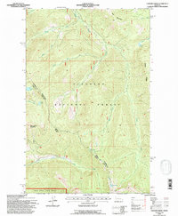
1994 Map of Connor Creek
USGS Topo · Published 1996About this map
Flathead National Forest defines the mountain landscape of this 1994 survey, where the peaks of Kah Mountain and Spring Slide Mountain overlook a complex network of high-country drainage. The map documents a rugged interior geography shaped by the North Fork and South Fork of Connor Creek, alongside the steep elevation of Bruce Ridge. A remote Shelter Cabin and the Ranger Trail provide evidence of forest management and early backcountry travel routes through the deep woods north of the Swan River State Forest. Numerous glacial lakes, including Trinkus Lake, Soldier Lake, and Bond Lake, are scattered across the terrain. The presence of the Fourth Standard Parallel North and the Guide Meridian West marks the fundamental surveying framework used to organize this vast wilderness area in the late twentieth century.
Find a feature on this map
28 named features on this map. Tap any name to fly to it.
Don’t see what you’re looking for? This feature index may not catch every label — zoom into the map to look around manually.
Map Details
Editions of this 1994 Connor Creek Map
This is the sole edition of this map. No revisions or reprints were ever made.
Other maps of this area

1914 · Nyack
USGS Topo · 1:125,000

1955 · Choteau
USGS Topo · 1:250,000

1957 · Choteau
USGS Topo · 1:250,000

1958 · Choteau
USGS Topo · 1:250,000

1958 · Circus Peak
USGS Topo · 1:24,000

1958 · Quintonkon
USGS Topo · 1:24,000

1960 · Cut Bank
USGS Topo · 1:250,000

1962 · Choteau
USGS Topo · 1:250,000

1963 · Cut Bank
USGS Topo · 1:250,000

1964 · Cut Bank
USGS Topo · 1:250,000