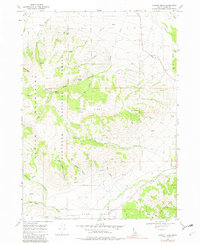
1968 Map of Connor Ridge
USGS Topo · Published 1982About this map
Albion Mountains and the Sawtooth National Forest dominate this topographical survey of southern Idaho, where high-elevation terrain gives way to deep drainages. The landscape is defined by the sharp rise of Connor Ridge and the Jim Sage Mts, separated by a complex network of canyons and hollows. Human activity is concentrated along the lower elevations, notably near the small settlement of Connor and the nearby Melcher Mine. Water management and recreational use are evident through the numerous charted springs, such as Bennett Spring and Rice Spring, alongside public sites like the Thompson Flat Campground and Twin Lakes Picnic Area. The map reveals a reliance on seasonal waterways and mountain access, with Jeep Trails and steep paths winding through White Pine Canyon and Broad Hollow, providing a detailed look at the rural and extractive infrastructure of Cassia County during the late 1960s.
Find a feature on this map
43 named features on this map. Tap any name to fly to it.
Don’t see what you’re looking for? This feature index may not catch every label — zoom into the map to look around manually.
Map Details
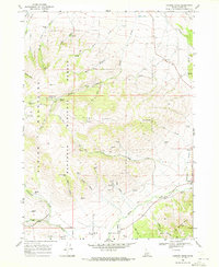
Editions of this 1968 Connor Ridge Map
2 editions found
Other maps of this area

1954 · Pocatello
USGS Topo · 1:250,000

1958 · Pocatello
USGS Topo · 1:250,000

1964 · View
USGS Topo · 1:24,000

1968 · Cache Peak
USGS Topo · 1:24,000

1968 · Idahome
USGS Topo · 1:24,000

1968 · Elba
USGS Topo · 1:24,000

1968 · Kane Canyon
USGS Topo · 1:24,000

1968 · Mount Harrison
USGS Topo · 1:24,000

1968 · Nibbs Creek
USGS Topo · 1:24,000

1968 · Albion
USGS Topo · 1:24,000