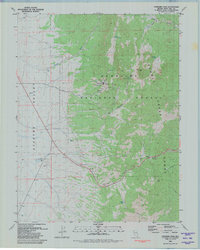
1981 Map of Connors Pass
USGS Topo · Published 1981About this map
Mining history and high-desert terrain dominate this 1981 survey of the eastern Schell Creek Range. The settlement of Taylor sits at the heart of an active resource landscape, surrounded by specialized workings including the Monitor Mine, Argus Mine, and the Reynolds Tunnel. A local Cem and scattered Ruins suggest the depth of human occupancy in this canyon environment, while infrastructure like the Taylor Shaft and various Borrow Pit excavations track the industrial footprint of the era.
Find a feature on this map
35 named features on this map. Tap any name to fly to it.
Don’t see what you’re looking for? This feature index may not catch every label — zoom into the map to look around manually.
Map Details
Editions of this 1981 Connors Pass Map
3 editions found
Other maps of this area

1952 · Ely
USGS Topo · 1:125,000

1956 · Lund
USGS Topo · 1:250,000

1956 · Ely
USGS Topo · 1:250,000

1958 · Comins Lake
USGS Topo · 1:24,000

1958 · Ely
USGS Topo · 1:62,500

1959 · Ely
USGS Topo · 1:250,000

1959 · Connors Pass
USGS Topo · 1:62,500

1960 · Lund
USGS Topo · 1:250,000

1963 · Ely
USGS Topo · 1:250,000
1973 · White Rock Creek
USGS Topo · 1:24,000