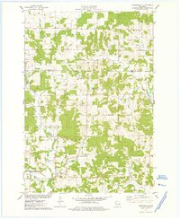
1975 Map of Connorsville
USGS Topo · Published 1978About this map
Connorsville serves as a central hub in this mid-1970s landscape, where the rural character of northern Dunn County meets the Barron County line. The map reveals a region defined by its complex drainage systems, including the South Fork Hay River and Vance Creek. Small family and community landmarks like Akers Cem and Solum Cem are scattered across the terrain, reflecting generations of local settlement.
Find a feature on this map
28 named features on this map. Tap any name to fly to it.
Don’t see what you’re looking for? This feature index may not catch every label — zoom into the map to look around manually.
Map Details
Editions of this 1975 Connorsville Map
This is the sole edition of this map. No revisions or reprints were ever made.
Other maps of this area

1948 · Downing
USGS Topo · 1:62,500

1949 · Ridgeland
USGS Topo · 1:62,500

1950 · Downing
USGS Topo · 1:62,500

1950 · Turtle Lake
USGS Topo · 1:62,500

1951 · Ridgeland
USGS Topo · 1:62,500

1951 · Barron
USGS Topo · 1:62,500

1952 · Turtle Lake
USGS Topo · 1:62,500

1953 · Rice Lake
USGS Topo · 1:250,000

1953 · Stillwater
USGS Topo · 1:250,000

1955 · Stillwater
USGS Topo · 1:250,000