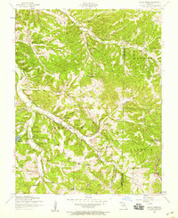
1954 Map of Conns Creek
USGS Topo · Published 1959About this map
Sellars and St John are small anchors within this mid-century landscape where Camden County meets Pulaski County. The terrain is defined by a dense network of hollows and creek beds, including Wet Glaize Creek, Conns Creek, and Deberry Creek. Social life in these rural townships is marked by numerous country churches such as Mountview Church and Elm Grove Church.
Find a feature on this map
31 named features on this map. Tap any name to fly to it.
Don’t see what you’re looking for? This feature index may not catch every label — zoom into the map to look around manually.
Map Details
Editions of this 1954 Conns Creek Map
2 editions found
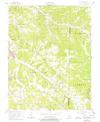
Other maps of this area

1888 · Versailles
USGS Topo · 1:125,000

1888 · Tuscumbia
USGS Topo · 1:125,000

1893 · Versailles
USGS Topo · 1:125,000

1894 · Tuscumbia
USGS Topo · 1:125,000

1932 · Versailles No 4
USGS Topo · 1:48,000

1933 · Stoutland
USGS Topo · 1:62,500

1933 · Iberia
USGS Topo · 1:62,500

1934 · Toronto
USGS Topo · 1:24,000

1937 · Iberia
USGS Topo · 1:62,500

1938 · Stoutland
USGS Topo · 1:62,500