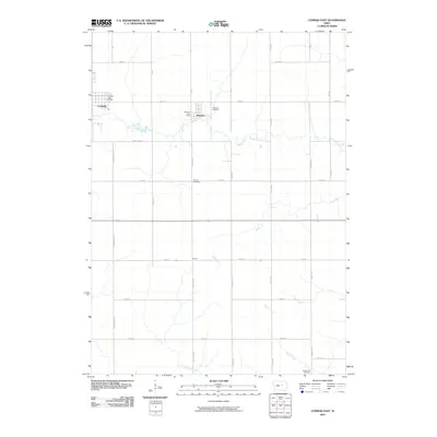
2010 Map of Conrad East
USGS Topo · Published 2010About this map
Conrad and Beaman anchor this section of Grundy County, showcasing the organized grid of rural Iowa at the turn of the 21st century. The landscape is defined by the agricultural sections carved out by roads like Underwood Ave and Abbott Ave, punctuated by small settlements and legacy sites. Along the meandering path of Wolf Creek, the small village of Vienna and its associated Vienna Cemetery offer a look into the long-standing community centers of the region.
Find a feature on this map
35 named features on this map. Tap any name to fly to it.
Don’t see what you’re looking for? This feature index may not catch every label — zoom into the map to look around manually.
Map Details
Editions of this 2010 Conrad East Map
This is the sole edition of this map. No revisions or reprints were ever made.
Other maps of this area

1954 · Waterloo
USGS Topo · 1:250,000

1955 · Waterloo
USGS Topo · 1:250,000

1960 · Marshalltown
USGS Topo · 1:24,000

1960 · Marshalltown
USGS Topo · 1:62,500

1960 · Le Grand
USGS Topo · 1:24,000

1960 · Conrad West
USGS Topo · 1:24,000

1960 · Conrad East
USGS Topo · 1:24,000

1971 · Lincoln
USGS Topo · 1:24,000

1971 · Garwin
USGS Topo · 1:24,000
1971 · Gladbrook
USGS Topo · 1:24,000