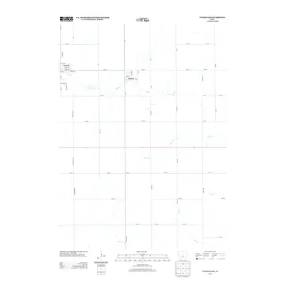
2013 Map of Conrad East
USGS Topo · Published 2013About this map
Conrad and Beaman anchor this section of Grundy County, showcasing the rigid township and range grid that defines the Iowa agricultural landscape. The map captures a moment in 2013 where the residential expansion of Conrad is visible near the Conrad Golf Course, while the surrounding terrain remains deeply rural. Waterways like Wolf Cr and Devils Run break the geometric precision of the county roads, creating natural drainages that have influenced farmstead placement for generations. To the south, the small community of Vienna sits at the intersection of 130th St and Wallace Ave, providing a window into the historical density of crossroads settlements. The detailed labeling of rural routes, including Duesenberg Dr and Hawk Ave, allows for precise tracing of family land holdings across this productive corn-belt region.
Find a feature on this map
49 named features on this map. Tap any name to fly to it.
Don’t see what you’re looking for? This feature index may not catch every label — zoom into the map to look around manually.
Map Details
Editions of this 2013 Conrad East Map
This is the sole edition of this map. No revisions or reprints were ever made.
Other maps of this area

1954 · Waterloo
USGS Topo · 1:250,000

1955 · Waterloo
USGS Topo · 1:250,000

1960 · Marshalltown
USGS Topo · 1:24,000

1960 · Marshalltown
USGS Topo · 1:62,500

1960 · Le Grand
USGS Topo · 1:24,000

1960 · Conrad West
USGS Topo · 1:24,000

1960 · Conrad East
USGS Topo · 1:24,000

1971 · Lincoln
USGS Topo · 1:24,000

1971 · Garwin
USGS Topo · 1:24,000
1971 · Gladbrook
USGS Topo · 1:24,000