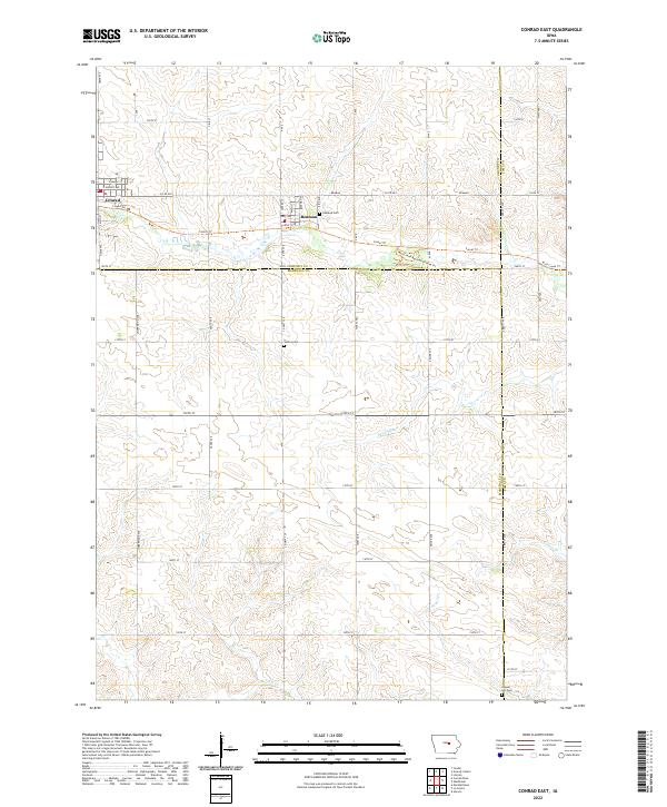
2022 Map of Conrad East
USGS Topo · Published 2022About this map
Beaman and the eastern edge of Conrad serve as the primary anchors in this landscape at the intersection of Grundy, Marshall, and Tama Counties. The map reveals a transition from these agricultural hubs into a network of creek drainages, most notably Wolf Creek and its associated recreational paths. Genealogists will find three distinct burial sites across the township lines, including Oakland Cemetery near the heart of Beaman and the more isolated Vienna Cemetery and Chapel Hill Cemetery. The conversion of former rail corridors into the Comet Trail and the Wolf Creek Recreation Area Trail reflects a modern reuse of the area's historic transportation infrastructure. Numerous named waterways like Devils Run, Sugar Creek, and Burnett Creek wind through the section lines, defining the topography of this rural central Iowa corridor.
Find a feature on this map
54 named features on this map. Tap any name to fly to it.
Don’t see what you’re looking for? This feature index may not catch every label — zoom into the map to look around manually.
Map Details
Editions of this 2022 Conrad East Map
This is the sole edition of this map. No revisions or reprints were ever made.
Other maps of this area

1954 · Waterloo
USGS Topo · 1:250,000

1955 · Waterloo
USGS Topo · 1:250,000

1960 · Marshalltown
USGS Topo · 1:24,000

1960 · Marshalltown
USGS Topo · 1:62,500

1960 · Le Grand
USGS Topo · 1:24,000

1960 · Conrad West
USGS Topo · 1:24,000

1960 · Conrad East
USGS Topo · 1:24,000

1971 · Lincoln
USGS Topo · 1:24,000

1971 · Garwin
USGS Topo · 1:24,000
1971 · Gladbrook
USGS Topo · 1:24,000