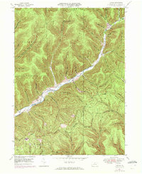
1947 Map of Conrad
USGS Topo · Published 1972About this map
The tiny settlement of Conrad sits at the confluence of several mountain streams, anchored by the Sinnemahoning Creek East Fork. This 1947 field-checked survey reveals the deep-cut valleys and ridges of Potter County, where life followed the winding path of East Fork Road and its tributaries. For those tracing family ties to this remote timber and gas region, the map preserves the locations of McFall Cem and Brooks Cem, along with topographic landmarks like Bunnell Ridge and Pine Hill.
Find a feature on this map
55 named features on this map. Tap any name to fly to it.
Don’t see what you’re looking for? This feature index may not catch every label — zoom into the map to look around manually.
Map Details
Editions of this 1947 Conrad Map
5 editions found
Other maps of this area

1945 · Driftwood
USGS Topo · 1:48,000

1945 · First Fork
USGS Topo · 1:24,000

1946 · Renovo West
USGS Topo · 1:62,500

1946 · Hammersley Fork
USGS Topo · 1:24,000

1946 · Tamarack
USGS Topo · 1:24,000

1947 · First Fork
USGS Topo · 1:24,000

1947 · Conrad
USGS Topo · 1:62,500

1947 · Conrad
USGS Topo · 1:24,000

1947 · Short Run
USGS Topo · 1:24,000

1947 · Ayers Hill
USGS Topo · 1:24,000
Featured Places
- Wharton Township, PA
- Summit Township, PA
- Sylvania Township, PA
- Hammersley, Wharton Township
- Logue, Wharton Township