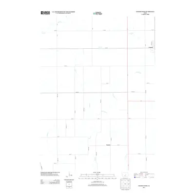
2013 Map of Conrad West
USGS Topo · Published 2013About this map
Asher Cr and its tributaries carve a winding path through the agricultural landscape of Grundy County, defining the drainage patterns of this central Iowa region. The settlement of Conrad sits at the eastern edge of the quadrangle, serving as a focal point for the local rural community. Further south, the map identifies the location of Maulsby, situated near the intersection of Reed Ave and 145th St. This 2013 survey illustrates the highly organized section-line road network that facilitates transit between farms and towns, featuring routes such as Marble Rd and Co Hwy S75. Small water bodies like Wolf Cr and Little Asher Cr break up the geometric precision of the fields, indicating the natural hydrology that has long influenced land use in this part of the state.
Find a feature on this map
29 named features on this map. Tap any name to fly to it.
Don’t see what you’re looking for? This feature index may not catch every label — zoom into the map to look around manually.
Map Details
Editions of this 2013 Conrad West Map
This is the sole edition of this map. No revisions or reprints were ever made.
Other maps of this area

1954 · Waterloo
USGS Topo · 1:250,000

1955 · Waterloo
USGS Topo · 1:250,000

1960 · Marshalltown
USGS Topo · 1:24,000

1960 · Marshalltown
USGS Topo · 1:62,500

1960 · Le Grand
USGS Topo · 1:24,000

1960 · Conrad West
USGS Topo · 1:24,000

1960 · Conrad East
USGS Topo · 1:24,000

1975 · Union
USGS Topo · 1:24,000
1975 · La Moille
USGS Topo · 1:24,000

1979 · Grundy Center
USGS Topo · 1:24,000