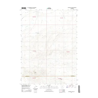
2015 Map of Continental Peak
USGS Topo · Published 2015About this map
Emigrant Trl cuts across the northwestern corner of this high-desert landscape, marking a historical path of westward migration through what is now the border of Fremont and Sweetwater counties. The terrain is defined by a series of drainage features and prominent elevations, most notably the high point at Continental Peak and the intricately weathered landforms of the Honeycomb Buttes to the southeast. These features sit within a network of ephemeral watercourses including Oregon Slough, Long Slough, and Harris Slough, which characterize the arid hydrologic patterns of the region.
Find a feature on this map
18 named features on this map. Tap any name to fly to it.
Don’t see what you’re looking for? This feature index may not catch every label — zoom into the map to look around manually.
Map Details
Editions of this 2015 Continental Peak Map
This is the sole edition of this map. No revisions or reprints were ever made.
Other maps of this area

1953 · Radium Springs
USGS Topo · 1:24,000

1953 · Atlantic City
USGS Topo · 1:24,000

1953 · South Pass City
USGS Topo · 1:24,000

1955 · Lander
USGS Topo · 1:250,000

1958 · Lander
USGS Topo · 1:250,000

1958 · Circle Bar Lake
USGS Topo · 1:24,000

1958 · Freighter Gap
USGS Topo · 1:62,500

1958 · The Pinnacles
USGS Topo · 1:62,500

1958 · Dickie Springs
USGS Topo · 1:24,000

1958 · Continental Peak
USGS Topo · 1:24,000