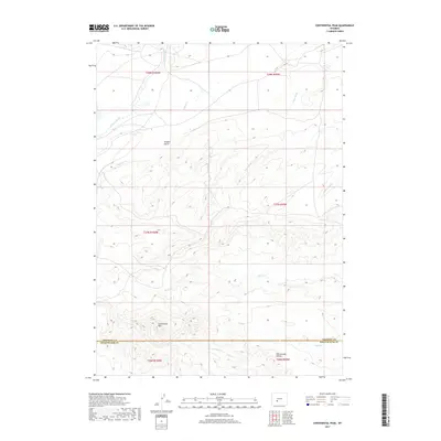
2017 Map of Continental Peak
USGS Topo · Published 2017About this map
Continental Peak rises as a prominent high point in this high-desert landscape, marking the divide between the Fremont and Sweetwater County line. The terrain is characterized by a complex drainage system of sloughs and creeks, including the winding Oregon Slough and Long Slough, which suggest a seasonal hydrology typical of the Red Desert region. To the southeast, the eroded badlands of the Honeycomb Buttes provide a distinctive geological focal point. This 2017 survey reflects a largely undeveloped landscape where traditional topographic features like Oregon Gulch and Meadow Cr remain the primary landmarks for navigation. The map captures the intersection of several townships, tracing the natural and political boundaries that define this remote corner of Wyoming.
Find a feature on this map
17 named features on this map. Tap any name to fly to it.
Don’t see what you’re looking for? This feature index may not catch every label — zoom into the map to look around manually.
Map Details
Editions of this 2017 Continental Peak Map
This is the sole edition of this map. No revisions or reprints were ever made.
Other maps of this area

1953 · Radium Springs
USGS Topo · 1:24,000

1953 · Atlantic City
USGS Topo · 1:24,000

1953 · South Pass City
USGS Topo · 1:24,000

1955 · Lander
USGS Topo · 1:250,000

1958 · Lander
USGS Topo · 1:250,000

1958 · Circle Bar Lake
USGS Topo · 1:24,000

1958 · Freighter Gap
USGS Topo · 1:62,500

1958 · The Pinnacles
USGS Topo · 1:62,500

1958 · Dickie Springs
USGS Topo · 1:24,000

1958 · Continental Peak
USGS Topo · 1:24,000