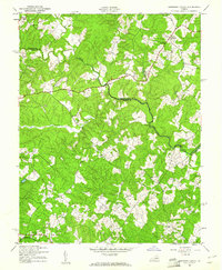
1942 Map of Contrary Creek
USGS Topo · Published 1961About this map
The North Anna River carves a winding path through the borderlands of Louisa and Spotsylvania counties, defining a landscape of wooded ridges and narrow valleys. This 1942 survey, mapped by the Army Map Service, captures the rural character of the region just before mid-century modernizations. Small upland settlements like Centreville and Glenora serve as focal points for the surrounding farmsteads, while the Chesapeake and Ohio railroad cuts across the southern edge of the quadrangle near Plum Tree.
Find a feature on this map
16 named features on this map. Tap any name to fly to it.
Don’t see what you’re looking for? This feature index may not catch every label — zoom into the map to look around manually.
Map Details
Editions of this 1942 Contrary Creek Map
2 editions found
Other maps of this area

1887 · Spottsylvania
USGS Topo · 1:125,000

1890 · Goochland
USGS Topo · 1:125,000

1892 · Spottsylvania
USGS Topo · 1:125,000

1892 · Goochland
USGS Topo · 1:125,000

1942 · Mineral
USGS Topo · 1:31,680

1942 · Lahore
USGS Topo · 1:31,680

1942 · Partlow
USGS Topo · 1:31,680

1942 · Belmont
USGS Topo · 1:31,680

1942 · Contrary Creek
USGS Topo · 1:31,680

1942 · Brokenburg
USGS Topo · 1:31,680