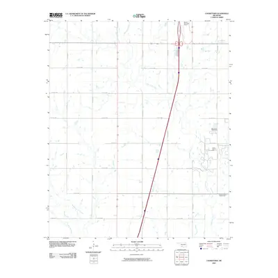
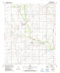
2009 Map of Cookietown
USGS Topo · Published 2009About this map
West Cache Creek meanders through this portion of Cotton County, defining a landscape marked by the intersection of traditional agricultural sections and the regional energy industry. The presence of the Soldier Creek Oil Field and the Essaquanahdale West Oil Field illustrates the long-standing importance of petroleum extraction in this Oklahoma prairie. In the northern reaches, the Walters Municipal Airport serves as a modern transportation anchor, while a rigorous grid of county roads, such as Co RD e1860 and Co RD n2550, organizes the rural terrain. The hydrology of the area is further shaped by the confluence of Deep Red Creek and Dry Red Creek, alongside water management features like the Oknoname 033004 Dam.
Find a feature on this map
22 named features on this map. Tap any name to fly to it.
Don’t see what you’re looking for? This feature index may not catch every label — zoom into the map to look around manually.
Map Details
Editions of this 2009 Cookietown Map
This is the sole edition of this map. No revisions or reprints were ever made.
Other maps of this area

1955 · Lawton
USGS Topo · 1:250,000

1957 · Burkburnett
USGS Topo · 1:62,500

1957 · Randlett
USGS Topo · 1:62,500

1962 · Chattanooga
USGS Topo · 1:62,500

1962 · Walters
USGS Topo · 1:62,500
1985 · Randlett
USGS Topo · 1:24,000
1985 · Taylor
USGS Topo · 1:24,000
1985 · Devol
USGS Topo · 1:24,000

1985 · Burkburnett
USGS Topo · 1:100,000
1987 · Faxon
USGS Topo · 1:24,000