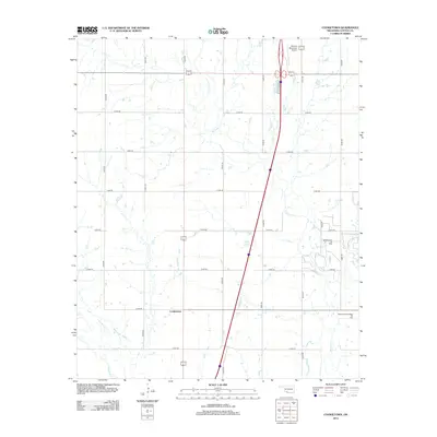
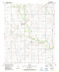
2012 Map of Cookietown
USGS Topo · Published 2012About this map
Cookietown anchors this portion of Cotton County, Oklahoma, sitting at the junction of several section-line roads in a landscape defined by prairie agriculture and energy extraction. The area's industrial character is marked by the Soldier Creek Oil Field and the Essaquanahdale West Oil Field, which speak to the region's long-standing connection to the petroleum industry. Drainage for these plains is provided by the meandering W Cache Cr, along with Dry Red Cr and Deep Red Cr in the southwest. A modern transportation corridor is represented by the highway and the Walters Municipal Airport in the north. The map's rigid grid of local routes, including e1880 RD and n2530 RD, illustrates the systematic land division characteristic of the Great Plains, where every mile is precisely measured for access to homesteads and oil leases.
Find a feature on this map
21 named features on this map. Tap any name to fly to it.
Don’t see what you’re looking for? This feature index may not catch every label — zoom into the map to look around manually.
Map Details
Editions of this 2012 Cookietown Map
This is the sole edition of this map. No revisions or reprints were ever made.
Other maps of this area

1955 · Lawton
USGS Topo · 1:250,000

1957 · Burkburnett
USGS Topo · 1:62,500

1957 · Randlett
USGS Topo · 1:62,500

1962 · Chattanooga
USGS Topo · 1:62,500

1962 · Walters
USGS Topo · 1:62,500
1985 · Randlett
USGS Topo · 1:24,000
1985 · Taylor
USGS Topo · 1:24,000
1985 · Devol
USGS Topo · 1:24,000

1985 · Burkburnett
USGS Topo · 1:100,000
1987 · Faxon
USGS Topo · 1:24,000