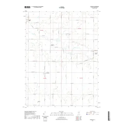
2018 Map of Cooksville
USGS Topo · Published 2018About this map
Cooksville and Colfax anchor this section of McLean County, where the agricultural grid is defined by a dense network of country roads. The Mackinaw River winds through the center of the quadrangle, joined by tributaries like Patton Cr, Henline Cr, and Little Crooked Cr. These waterways provide the primary relief in an otherwise strictly organized landscape of sections and ranges.
Find a feature on this map
58 named features on this map. Tap any name to fly to it.
Don’t see what you’re looking for? This feature index may not catch every label — zoom into the map to look around manually.
Map Details
Editions of this 2018 Cooksville Map
This is the sole edition of this map. No revisions or reprints were ever made.
Other maps of this area

1926 · Normal
USGS Topo · 1:62,500

1930 · Normal
USGS Topo · 1:62,500

1951 · Le Roy
USGS Topo · 1:62,500

1952 · Arrowsmith
USGS Topo · 1:62,500

1957 · Colfax
USGS Topo · 1:62,500

1958 · Peoria
USGS Topo · 1:250,000

1961 · Peoria
USGS Topo · 1:250,000

1963 · Peoria
USGS Topo · 1:250,000
1981 · Holder
USGS Topo · 1:24,000

1981 · Lexington
USGS Topo · 1:24,000