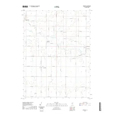
2021 Map of Cooksville
USGS Topo · Published 2021About this map
Cooksville and the surrounding agricultural landscape of McLean County are defined by a network of drainage creeks and the meandering Mackinaw River. This central Illinois prairie region shows a highly organized grid of county roads, such as Co RD 2150 N and E 1800 North Rd, which facilitate the region's deep connection to aviation and farming. A notable modern landmark is the Schertz Aerial Service - Cooksville Airport, reflecting the importance of aerial application in local agriculture. Several historic burial grounds, including Wiley Cem and Blue Mound Cem, are situated along these rural routes, providing primary points of interest for genealogists tracing local families. The water system, fed by Patton Cr, Henline Cr, and Little Crooked Cr, dictates the few breaks in the otherwise straight-edged sectional survey lines of the settlement near Pleasant Hill.
Find a feature on this map
30 named features on this map. Tap any name to fly to it.
Don’t see what you’re looking for? This feature index may not catch every label — zoom into the map to look around manually.
Map Details
Editions of this 2021 Cooksville Map
This is the sole edition of this map. No revisions or reprints were ever made.
Other maps of this area

1926 · Normal
USGS Topo · 1:62,500

1930 · Normal
USGS Topo · 1:62,500

1951 · Le Roy
USGS Topo · 1:62,500

1952 · Arrowsmith
USGS Topo · 1:62,500

1957 · Colfax
USGS Topo · 1:62,500

1958 · Peoria
USGS Topo · 1:250,000

1961 · Peoria
USGS Topo · 1:250,000

1963 · Peoria
USGS Topo · 1:250,000
1981 · Holder
USGS Topo · 1:24,000

1981 · Lexington
USGS Topo · 1:24,000