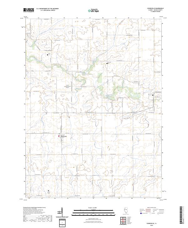
2024 Map of Cooksville
USGS Topo · Published 2024About this map
Cooksville serves as the primary hub of activity in this agricultural landscape of northeastern McLean County. The township is anchored by several small burial grounds that reflect generations of local families, including Wiley Cem and Evergreen Cem along the northern reaches, and Blue Mound Cem to the south. The natural drainage of the region is defined by the winding course of the Mackinaw River and its various tributaries such as Patton Creek and Henline Creek, which carve gentle paths through the surrounding prairie.
Find a feature on this map
52 named features on this map. Tap any name to fly to it.
Don’t see what you’re looking for? This feature index may not catch every label — zoom into the map to look around manually.
Map Details
Editions of this 2024 Cooksville Map
This is the sole edition of this map. No revisions or reprints were ever made.
Other maps of this area

1926 · Normal
USGS Topo · 1:62,500

1930 · Normal
USGS Topo · 1:62,500

1951 · Le Roy
USGS Topo · 1:62,500

1952 · Arrowsmith
USGS Topo · 1:62,500

1957 · Colfax
USGS Topo · 1:62,500

1958 · Peoria
USGS Topo · 1:250,000

1961 · Peoria
USGS Topo · 1:250,000

1963 · Peoria
USGS Topo · 1:250,000
1981 · Holder
USGS Topo · 1:24,000

1981 · Lexington
USGS Topo · 1:24,000