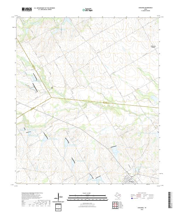
2022 Map of Coolidge
USGS Topo · Published 2022About this map
Coolidge sits at the southern edge of this map, serving as a hub where several county roads and farm-to-market routes converge near the City of Coolidge Lake Number 2. The landscape is defined by the intersection of three counties—Limestone, Hill, and Navarro—creating a rural patchwork of small-scale water management and agricultural drainage. Numerous reservoirs, such as Soil Conservation Service Site 8 Reservoir and Soil Conservation Service Site 106a Reservoir, are scattered throughout the terrain, highlighting a 20th-century focus on erosion control and water storage. In the north, Lake Dawson and the settlement of Eldorado Center mark the Navarro County line. The area is drained by a network of creeks including Alligator Cr and the multiple branches of Pin Oak Cr. Historical remnants like Dover Cem provide a focal point for genealogists tracing local families in this quiet corner of Central Texas.
Find a feature on this map
76 named features on this map. Tap any name to fly to it.
Don’t see what you’re looking for? This feature index may not catch every label — zoom into the map to look around manually.
Map Details
Editions of this 2022 Coolidge Map
This is the sole edition of this map. No revisions or reprints were ever made.
Other maps of this area

1920 · Mart
USGS Topo · 1:62,500

1954 · Waco
USGS Topo · 1:250,000

1955 · Waco
USGS Topo · 1:250,000

1956 · Hubbard
USGS Topo · 1:24,000

1956 · Dawson
USGS Topo · 1:24,000

1957 · Irene
USGS Topo · 1:24,000

1957 · Prairie Hill
USGS Topo · 1:24,000

1957 · Groesbeck
USGS Topo · 1:62,500

1960 · Echols
USGS Topo · 1:24,000

1960 · Tehuacana
USGS Topo · 1:24,000