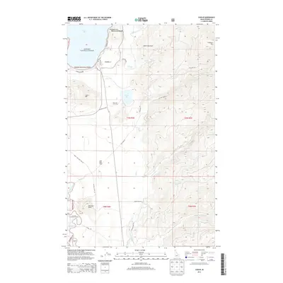
2013 Map of Coolin
USGS Topo · Published 2013About this map
Coolin sits at the southern reach of Priest Lake, serving as a primary gateway to the high timber and granite peaks of the Selkirk Mountains in this 2013 survey. The settlement pattern is defined by waterfront accessibility, with Sherwood Beach and Plumbago Point flanking the eastern shore. Away from the water, the landscape rises sharply into high-elevation landmarks like Sundance Mtn and Coolin Mtn, while the interior plateau features the smaller Chase Lake and its Chase Lake Access Area.
Find a feature on this map
39 named features on this map. Tap any name to fly to it.
Don’t see what you’re looking for? This feature index may not catch every label — zoom into the map to look around manually.
Map Details
Editions of this 2013 Coolin Map
This is the sole edition of this map. No revisions or reprints were ever made.
Other maps of this area

1901 · Sandpoint
USGS Topo · 1:125,000

1911 · Priest Lake
USGS Topo · 1:250,000

1911 · Sandpoint
USGS Topo · 1:125,000

1913 · Priest Lake
USGS Topo · 1:250,000

1958 · Sandpoint
USGS Topo · 1:250,000

1963 · Sandpoint
USGS Topo · 1:250,000

1967 · Quartz Mtn
USGS Topo · 1:24,000

1967 · Priest Lake SE
USGS Topo · 1:24,000

1967 · Coolin
USGS Topo · 1:24,000
1967 · Outlet Bay
USGS Topo · 1:24,000