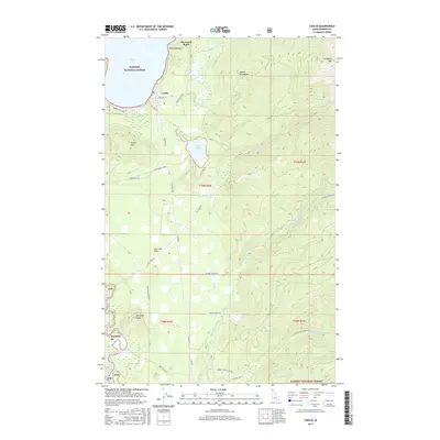
2017 Map of Coolin
USGS Topo · Published 2017About this map
Coolin serves as the primary gateway to the southeastern shores of Priest Lake, situated between the high peaks of the Selkirk Mountains and the waters of Cavanaugh Bay. This 2017 survey shows a landscape defined by its timber and recreation history, where the residential pockets of Sherwood Beach and Coolin meet the vast reaches of the Kaniksu National Forest. The road network, including East River Spr and Waters Creek Rd, reveals how modern access follows the natural drainages of the North Fork East River and Middle Fork East River.
Find a feature on this map
46 named features on this map. Tap any name to fly to it.
Don’t see what you’re looking for? This feature index may not catch every label — zoom into the map to look around manually.
Map Details
Editions of this 2017 Coolin Map
This is the sole edition of this map. No revisions or reprints were ever made.
Other maps of this area

1901 · Sandpoint
USGS Topo · 1:125,000

1911 · Priest Lake
USGS Topo · 1:250,000

1911 · Sandpoint
USGS Topo · 1:125,000

1913 · Priest Lake
USGS Topo · 1:250,000

1958 · Sandpoint
USGS Topo · 1:250,000

1963 · Sandpoint
USGS Topo · 1:250,000

1967 · Quartz Mtn
USGS Topo · 1:24,000

1967 · Priest Lake SE
USGS Topo · 1:24,000

1967 · Coolin
USGS Topo · 1:24,000
1967 · Outlet Bay
USGS Topo · 1:24,000