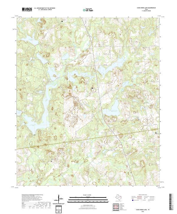
2022 Map of Coon Creek Lake
USGS Topo · Published 2022About this map
Coon Creek Lake and the meandering path of Catfish Cr define this rural landscape on the border of Henderson and Anderson counties. The area is characterized by an intricate network of waterways, including Shelton Mill Br, Pickle Br, and Goldman Br, which feed into numerous named reservoirs like Murchison Lake and Lucky Lake. This concentration of water resources suggests a region heavily utilized for ranching and private water management, with features like the Catfish Creek Ranch Lake marking significant landholdings.
Find a feature on this map
61 named features on this map. Tap any name to fly to it.
Don’t see what you’re looking for? This feature index may not catch every label — zoom into the map to look around manually.
Map Details
Editions of this 2022 Coon Creek Lake Map
This is the sole edition of this map. No revisions or reprints were ever made.
Other maps of this area

1949 · Palestine
USGS Topo · 1:62,500

1949 · Frankston
USGS Topo · 1:62,500

1949 · Athens
USGS Topo · 1:62,500

1949 · Tennessee Colony
USGS Topo · 1:62,500

1950 · Athens
USGS Topo · 1:62,500

1950 · Palestine
USGS Topo · 1:62,500

1950 · Frankston
USGS Topo · 1:62,500

1950 · Tennessee Colony
USGS Topo · 1:62,500

1953 · Palestine
USGS Topo · 1:250,000

1956 · Tyler
USGS Topo · 1:250,000